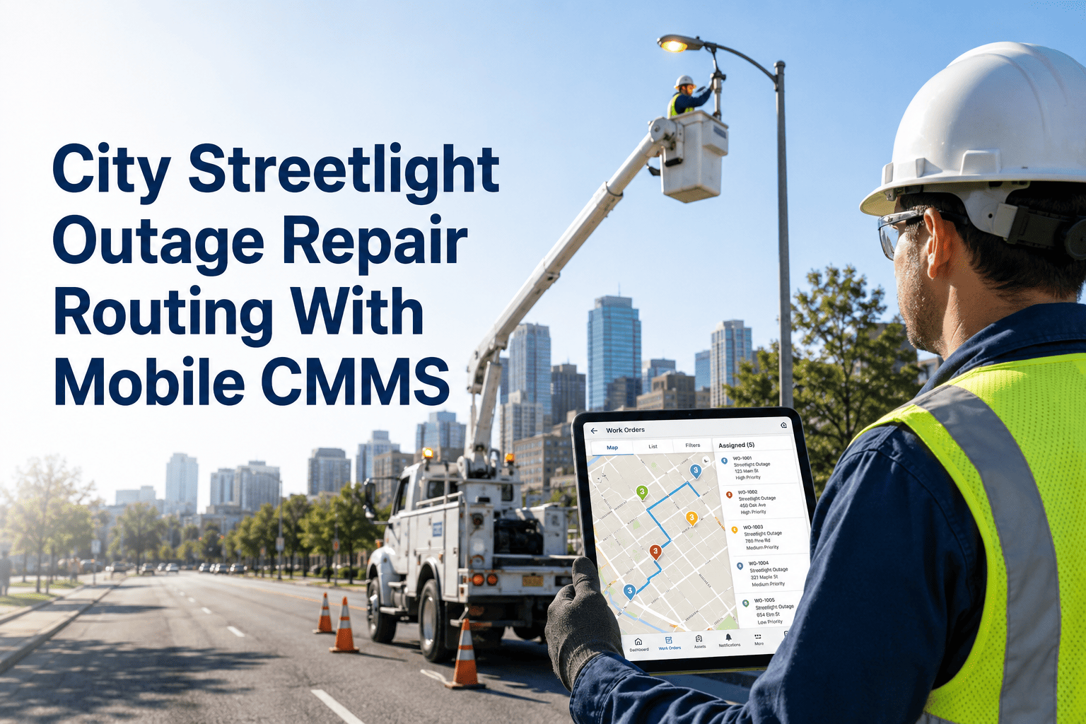
It's 11:43 PM. A citizen reports a dark intersection on Main Street after a vehicle accident damaged a light pole. The night crew dispatches—but they drive to the wrong location because the work order listed"Main St & Oak" while the actual outage is at "Main St & Oak Ave" three blocks away. Meanwhile, the dangerous intersection remains dark for another 45 minutes. This scenario happens across municipalities—but it's entirely preventable with modern location-based asset management systems.
Locations Workflow for Street Lighting Teams
Transform street light management from paper maps and address confusion to GPS-precise location workflows with real-time tracking
Municipal street lighting teams manage thousands of assets spread across hundreds of miles—light poles, fixtures, controllers, electrical panels, and underground infrastructure. Every asset needs precise location data for efficient maintenance, emergency response, and capital planning. Schedule a consultation to see how location workflows eliminate navigation confusion and response delays.
15,000+
Light Poles Per City
Average mid-size municipality inventory
23%
Wasted Drive Time
From incorrect location information
$127K
Annual Lost Productivity
From location-related inefficiencies
GPS
Precision Location
±3 meter accuracy for every asset
Core Problem: Paper maps, spreadsheet addresses, and verbal descriptions create dangerous gaps between reported outages and actual locations—regardless of how experienced your crews are.
Start your free trial to close these gaps with GPS-precise location workflows.
Street lighting departments must maintain comprehensive location documentation across multiple asset categories and operational requirements. Book a demo to see how Oxmaint location workflows address each requirement automatically.
GPS Coordinates: Precise latitude/longitude for every pole, fixture, and electrical component
Address Standardization: Consistent addressing format eliminating "Main St" vs "Main Street" confusion
Circuit Mapping: Electrical circuit assignments linking poles to controllers and panels
Zone/District Organization: Geographic grouping for route optimization and crew assignments
Consequences: Wrong-location dispatches, extended outage durations, citizen complaints, liability exposure
Turn-by-Turn Navigation: Direct routing from current location to work order destination
Proximity Search: Find nearest assets for troubleshooting circuit issues
Offline Maps: GPS navigation works without cellular coverage in rural areas
Reality: Paper maps get outdated, addresses are ambiguous, new crews get lost finding assets
Outage Heat Maps: Identify problem areas with recurring failures
Coverage Analysis: Dark spot identification for public safety planning
Capital Planning: Geographic prioritization for replacement programs
Impact: Reactive maintenance, missed dark spots, inefficient capital allocation, public safety risks
Lost in location confusion? See how Oxmaint location workflows give street lighting crews GPS-precise navigation, instant asset lookup, and real-time tracking with a single tap.
Modern location workflows transform every street light into a GPS-mapped asset. One tap unlocks precise navigation, complete history, and instant action capabilities. Create a free account to see GPS asset management with your street lighting inventory.
Street lighting teams manage infrastructure across entire municipalities—downtown corridors, residential neighborhoods, industrial zones, and rural outskirts. Centralized location tracking provides real-time visibility across your entire service area. Schedule a consultation to see how the system scales to your municipality.
Unified Geographic Database
Every asset mapped in single system: Light poles, fixtures, photocells, controllers, electrical panels, underground conduit, service points—5,000-50,000+ total assets with GPS coordinates, circuit assignments, maintenance history, and real-time status.
Real-Time Crew Tracking
Know where everyone is: Track crew locations in real-time, see work order progress, dispatch nearest available crew to emergency outages. Eliminate radio check-ins asking "where are you?"
Book technical consultation for fleet GPS integration.
Zone-Based Organization
Assets grouped by territory: See all street lights in Zone A, District 3, or Council Ward 7 in one view. Assign crews to geographic areas, balance workloads across zones, and track zone-specific performance metrics.
Manual dispatch of outage reports leads to confusion, delays, and wrong-location responses. Location workflows automate the entire process from citizen report to crew completion. Request an efficiency assessment to identify location-related delays in your current system.
Citizen Reports
Online form captures location via address or map pin. System automatically matches to nearest pole (Pole #4521) and validates GPS coordinates.
↓
Auto-Dispatch
Work order created with GPS location, assigned to nearest available crew. Turn-by-turn navigation sent to crew's mobile device.
↓
Result
GPS-Precise: Crew arrives at exact location in 18 minutes vs. traditional dispatch = 45+ minutes with wrong-location risk + citizen callback for clarification
Calculate your location efficiency. Free assessment shows how much time your crews lose to location confusion and how GPS workflows cut response times by 40-60%.
Phased approach ensures operational continuity while building comprehensive location database. Most municipalities complete deployment in 6-10 weeks. Get your customized roadmap with timeline and resource requirements.
One district: Downtown or high-complaint area
□ Import existing inventory (1,000-3,000 poles)
□ GPS verification of pilot zone assets
□ Configure zone boundaries
□ Train pilot crew (4-6 technicians)
□ Run parallel with existing system
Success: 90%+ location accuracy, crews navigating via GPS, response times improving
Expand: All zones and crew teams
□ Complete GPS inventory verification
□ Deploy to all field crews
□ Configure circuit mapping
□ Integrate citizen reporting portal
□ Activate real-time crew tracking
Success: 100% assets mapped, all crews using GPS navigation, dispatch automated
Full capability: Analytics, reporting, advanced features
□ Outage heat map dashboards
□ Route optimization active
□ Capital planning integration
□ Performance analytics live
□ Retire paper maps & spreadsheets
Challenge
Council audit revealed 28% of outage response times exceeded 72-hour SLA due to location confusion. Crews frequently arrived at wrong locations, citizens called back to clarify addresses, and supervisors spent hours on radio coordinating dispatches. Paper maps were 5+ years outdated with 2,000+ new poles not documented.
Solution
Deployed Oxmaint location workflows across 12 zones in 8 weeks • 18,500 poles GPS-verified • Mobile app to all 24 technicians • Citizen portal with map-based reporting • Real-time crew tracking activated • Automated dispatch based on GPS proximity
Results (90 Days)
SLA Compliance:
72% → 96%
Avg Response Time:
54hrs → 19hrs
Wrong-Location Dispatches:
23% → 2%
Work Orders/Day:
+34% Completed
"The GPS location system transformed our operations. Before, we had crews driving around looking for poles based on vague addresses. Now they tap the work order and navigate directly to the exact GPS coordinates. Our technicians complete 34% more work orders per day simply because they're not wasting time finding assets. Citizens noticed too—complaints about dark streets dropped by half." — Public Works Director
Start your location workflow transformation. Create free account and map your first zone's street lights. See how GPS-precise asset management eliminates location confusion.
Generate outage heat maps, zone performance reports, and capital planning analysis automatically. See location analytics configured for street lighting operations.
Outage Heat Maps
Visual Analysis: Color-coded maps showing outage frequency by location. Identify problem circuits, aging infrastructure clusters, and vandalism hot spots.
Target preventive maintenance to high-failure areas
Zone Performance Dashboard
Real-Time: Response times, completion rates, backlog counts, and SLA compliance by geographic zone. Compare crew performance across territories.
Balance workloads and optimize crew assignments
Coverage Analysis Reports
Safety Planning: Identify dark spots, spacing gaps, and areas needing additional lighting. Support public safety initiatives with data-driven recommendations.
Proactive expansion planning vs. reactive complaints
Capital Planning Maps
Budget Prioritization: Age analysis, failure rates, and replacement costs by geographic area. Visual prioritization for multi-year capital programs.
Data-driven capital budget justification
Location workflows flip the paradigm: GPS precision becomes the foundation of every operation. When citizens report outages with map pins, they create exact coordinates. When crews navigate via GPS, they arrive at the right location every time. When supervisors see real-time crew positions, they dispatch intelligently.
Street lighting departments with comprehensive location-based asset management reduce response times, eliminate wrong-location dispatches, improve SLA compliance, optimize crew productivity, and deliver better service to citizens. Schedule your demo or start your free trial today.
Oxmaint CMMS is designed for municipal street lighting requirements—from GPS mapping to citizen portals. Built by engineers who understand public works operations and infrastructure management needs.
For Municipal Leaders: Free inventory audit + GPS implementation roadmap included
How do we get GPS coordinates for 15,000+ existing poles?
Multiple approaches work together: Import existing GIS data if available (most municipalities have partial data), use mobile app GPS capture during routine maintenance visits (crews verify/update coordinates as they work), and bulk GPS collection drives for priority areas. Most departments achieve 80% coverage within 60 days through normal work activities, with dedicated verification completing the remaining 20%. The system flags low-confidence locations for priority verification.
Does the GPS navigation work in rural areas without good cell coverage?
Yes—the mobile app downloads maps and work order data when connected, then works fully offline. Crews can navigate via GPS, complete inspections, and create work orders without cellular signal. Data syncs automatically when connection is restored. This is critical for rural municipalities where cell coverage is spotty. We recommend crews sync their devices at the start of each shift to ensure they have current data.
Can citizens report outages using GPS location instead of addresses?
Absolutely. The citizen portal includes an interactive map where residents can drop a pin on the exact location. The system automatically matches the GPS coordinates to the nearest pole and creates a work order with verified location data. This eliminates the "Main St vs Main Street" confusion and ensures crews navigate to the exact spot. Citizens can also attach photos which include GPS metadata for additional verification.
How does this integrate with our existing GIS system?
Oxmaint provides bidirectional GIS integration via industry-standard formats (Shapefile, GeoJSON, WFS/WMS). Import your existing asset layers, and changes made in Oxmaint can sync back to your GIS. Most municipalities maintain Oxmaint as the operational system-of-record with periodic exports to GIS for enterprise mapping. We also integrate with Esri ArcGIS, Google Maps Platform, and other common GIS tools.
What about tracking underground infrastructure and conduit?
The location system handles all infrastructure types—above-ground poles, underground conduit runs, junction boxes, pull boxes, and service connection points. You can map conduit paths as line features, link them to the poles they serve, and include depth/material attributes. This is especially valuable for locating underground faults and coordinating with other utilities during excavation projects.