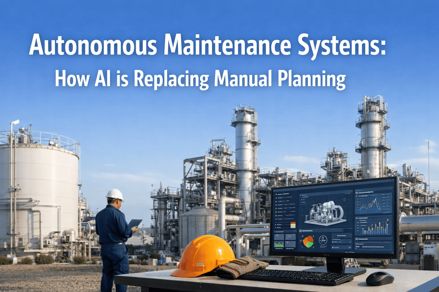
Best Quadruped Robot Digital Twin & 3D Mapping for Facility Maintenance in 2026
Every industrial facility is a living, changing environment — pipes corrode, equipment shifts, new assets are installed, and layouts evolve. Yet most maintenance teams still rely on outdated 2D blueprints and static CAD models that diverge from reality the moment construction ends. Quadruped robots equipped with LiDAR scanners and photogrammetry cameras are now autonomously walking through plants, warehouses, and substations to build centimeter-accurate 3D digital twins that update continuously. But the true breakthrough isn't the map itself — it's what happens when that spatial intelligence connects to a CMMS like Oxmaint. Every asset in the digital twin becomes a live maintenance object — with work orders, PM schedules, inspection histories, and condition data linked directly to its exact 3D location. Start Free Trial.
Why Static Facility Records Fail Modern Maintenance
Maintenance teams lose thousands of hours annually searching for assets, verifying locations, and cross-referencing outdated floor plans. When a technician receives a work order for "Pump P-2104" but the pump has been relocated, re-piped, or surrounded by new equipment since the last blueprint update, response times balloon. Digital twins built by quadruped robots eliminate this gap — providing a spatially accurate, continuously updated view of your facility that lives inside your CMMS.
73%
Of facility blueprints are outdated within 12 months of creation
$184B
Global digital twin market projected by 2030
±2cm
LiDAR point cloud accuracy from quadruped-mounted scanners
What Makes Quadruped-Built Digital Twins Different from Traditional Surveys
Traditional facility surveys require specialised surveyors, tripod-mounted scanners, and weeks of manual stitching — producing a static snapshot that begins aging immediately. Quadruped robots transform this into an autonomous, repeatable, living process that updates your digital twin as often as your facility changes.
Traditional Survey Methods
Requires manual tripod placement at hundreds of scan positions
Weeks of post-processing to register and stitch point clouds
Static output — outdated as soon as any facility change occurs
Cannot access confined spaces, multi-level catwalks, or hazardous zones
Quadruped Robot LiDAR Mapping
Autonomous walk-throughs with continuous scanning — no manual setup
Real-time SLAM processing delivers usable 3D models within hours
Repeatable patrols keep the digital twin updated weekly or daily
Navigates stairs, catwalks, confined spaces, and hazardous environments
Ready to build a living digital twin of your facility? Join maintenance teams using Oxmaint to sync 3D spatial data with automated maintenance workflows.
From LiDAR Scan to Maintenance Action: How the Digital Twin Workflow Operates
The value of a digital twin isn't the 3D model — it's the maintenance intelligence embedded within it. When quadruped robots scan your facility and that spatial data flows into Oxmaint's CMMS, every pipe, pump, valve, and panel becomes a clickable, trackable, maintainable object tied to its exact physical location. Here's how the closed-loop workflow operates:
The Digital Twin Maintenance Loop
Quadruped Robot Scans the Facility
Robot autonomously navigates pre-programmed routes through the facility, capturing millions of LiDAR points per second alongside 360° photogrammetry, thermal imagery, and RGB video from every angle and elevation.
SLAM Engine Builds the 3D Point Cloud
Simultaneous Localisation and Mapping (SLAM) algorithms process raw LiDAR data in real time, generating a dense, geometrically accurate 3D point cloud of the entire facility — including hard-to-reach areas, overhead piping, and below-grade infrastructure.
AI Segments and Tags Assets Automatically
Deep learning models identify and classify individual assets within the point cloud — pipes, valves, motors, tanks, electrical panels, structural members — assigning unique asset IDs that match or extend your existing asset register.
Oxmaint CMMS Syncs Asset Data in Real Time
Tagged assets flow into Oxmaint's CMMS with 3D coordinates, condition photos, and spatial relationships. Each asset becomes a live maintenance record — click any object in the digital twin to view work orders, PM schedules, inspection history, and spare parts linked to that exact location.
Change Detection Triggers Maintenance Workflows
When subsequent robot scans detect physical changes — corrosion growth, pipe displacement, missing equipment, thermal anomalies — Oxmaint automatically generates work orders with before/after 3D comparisons, precise location coordinates, and severity classifications.
Six Core Capabilities of Digital Twin-Powered Maintenance
A CMMS-connected digital twin isn't just a 3D visualisation — it's a spatially intelligent maintenance platform. From automated change detection to technician navigation, these capabilities transform how maintenance teams plan, execute, and verify work across complex facilities.
3D Asset Registration
Every asset is geo-located in 3D space with centimeter accuracy. New assets are automatically discovered during scans and flagged for registration — eliminating the "phantom asset" problem that plagues manual registers.
Automated Change Detection
Scan-to-scan comparison identifies physical changes — corrosion progression, structural deformation, missing components, unauthorised modifications — triggering CMMS work orders with 3D before/after evidence.
Spatial Work Order Context
Technicians open a work order in Oxmaint and see the exact 3D location of the asset — with navigation paths, surrounding equipment clearances, and access point recommendations. No more searching for "Valve V-3201."
Thermal Overlay Mapping
Thermal data captured during robot patrols is mapped onto the 3D model, creating facility-wide heat maps that identify insulation failures, electrical hot spots, and HVAC inefficiencies linked to specific assets.
Predictive Degradation Trending
Historical scan comparisons build degradation rate models for corrosion, coating loss, structural deflection, and equipment drift — predicting maintenance needs months before failure through spatial trend analysis.
Shutdown & Turnaround Planning
Plan maintenance shutdowns using the digital twin to sequence work, identify spatial conflicts between concurrent jobs, calculate crane paths, and simulate scaffolding placement — reducing turnaround duration by 15-30%.
See digital twin maintenance in action. Book a personalised demo and we'll walk through how LiDAR scan data syncs with automated work orders in Oxmaint.
Where Digital Twin Maintenance Delivers the Biggest Impact
Different industrial sectors face unique spatial challenges — from miles of piping in refineries to multi-story clean rooms in semiconductor fabs. Quadruped-built digital twins adapt to each, and Oxmaint's CMMS ensures that spatial intelligence translates into industry-specific maintenance execution.
Oil & Gas
ScansPipe racks, vessels, offshore platforms, tank farms
Quantified Results: What the Numbers Actually Show
Digital twin-powered maintenance doesn't improve one metric — it creates compounding efficiencies across asset management, work execution, and shutdown planning. Here's what facility operators consistently report from real-world deployments of quadruped-built digital twins integrated with CMMS.
65%Reduction in time locating assets for maintenance work
30%Shorter planned shutdown durations using spatial sequencing
90%Improvement in as-built documentation accuracy
280%Average 3-year ROI for digital twin + CMMS integration
Model the ROI for your facility. Create a free Oxmaint account and our team will help calculate your projected savings from digital twin + CMMS integration.
Your Deployment Path: Baseline Scan to Living Digital Twin
A phased rollout minimises risk while proving value fast. Most facilities complete the initial baseline scan and CMMS integration within 8-14 weeks, with the digital twin continuously improving in resolution and maintenance intelligence from day one. Book a Demo.
Phase 1
Facility Assessment & Route Planning
Week 1-3
Survey facility layout, identify scan priorities, map robot access routes including stairs and confined spaces. Define asset register alignment strategy and CMMS integration points with Oxmaint.
Phase 2
Baseline 3D Scan & Model Generation
Week 4-8
Deploy quadruped robot for comprehensive facility scanning. Process LiDAR point clouds into registered 3D models. Run AI asset segmentation and tagging. Validate spatial accuracy against known reference points.
Phase 3
CMMS Integration & Data Sync
Week 8-12
Connect digital twin asset data to Oxmaint CMMS. Map 3D-tagged assets to existing asset records. Configure automated work order generation from change detection alerts. Test end-to-end workflow from scan to dispatched work order.
Phase 4
Living Twin & Continuous Updates
Week 13+
Activate recurring autonomous scan schedules — weekly, bi-weekly, or monthly depending on facility change rate. Enable change detection, predictive degradation trending, and spatial maintenance analytics. Book a demo to get a customised deployment plan for your facility.
A digital twin without a CMMS is a pretty picture. A CMMS without a digital twin is guessing where your assets are. When the quadruped robot connects the two — scanning every week, syncing every change — you finally have a maintenance system that knows your facility as well as your most experienced operator.
— Facility Reliability Engineering Manager
Turn Every 3D Scan Into Smarter Maintenance
Your digital twin is only as powerful as the maintenance system behind it. Oxmaint connects quadruped robot LiDAR data to automated maintenance workflows — spatial changes become work orders, asset locations are always accurate, and your facility gets smarter with every scan.
How does a quadruped robot build a digital twin of my facility?
The robot carries LiDAR scanners that emit thousands of laser pulses per second, measuring distances to surrounding surfaces to create a dense 3D point cloud. SLAM (Simultaneous Localisation and Mapping) algorithms stitch these measurements together as the robot walks through the facility, building a geometrically accurate model with ±2cm precision. 360° cameras and thermal sensors add visual and thermal layers to the point cloud. AI then automatically identifies and tags individual assets — pipes, valves, motors, panels — within the model.
How does Oxmaint CMMS connect to the digital twin?
Oxmaint provides REST API endpoints that receive structured asset data from digital twin platforms. Each asset identified in the 3D model is synced to Oxmaint with its precise coordinates, condition photos, and spatial relationships. When change detection algorithms identify a physical anomaly — corrosion growth, equipment displacement, thermal hot spot — Oxmaint automatically generates a prioritised work order with 3D location context, before/after comparisons, and recommended actions. Sign up for a free account to explore integration capabilities.
How often should the robot rescan the facility?
Scan frequency depends on your facility's rate of change. High-change environments like active construction sites or plants undergoing modifications benefit from weekly scans. Stable facilities typically rescan monthly or quarterly. Critical areas — corrosion-prone zones, high-value equipment — can be scanned more frequently while low-change areas are scanned less often. The CMMS historical data helps optimise scan schedules by showing which areas generate the most change-triggered work orders.
Can the digital twin integrate with our existing BIM or CAD models?
Yes. LiDAR point clouds can be registered against existing BIM (Revit, Navisworks) or CAD models to identify as-built vs. as-designed deviations. This is particularly valuable for brownfield facilities where original drawings are unreliable. The robot's scan serves as the ground truth, and discrepancies between the scan and existing models are flagged as maintenance or documentation issues within Oxmaint's CMMS.
What ROI can we realistically expect from digital twin + CMMS integration?
Facilities report an average 280% three-year ROI driven by reduced asset location time (65% faster), shorter planned shutdowns (15-30% duration reduction), eliminated re-work from outdated drawings, and predictive maintenance enabled by spatial trend analysis. Payback periods typically range from 10-18 months. The compounding value of a continuously updated spatial record — combined with change detection that triggers proactive maintenance — grows ROI year over year as the digital twin accumulates historical data. Schedule a consultation to model ROI for your facility.