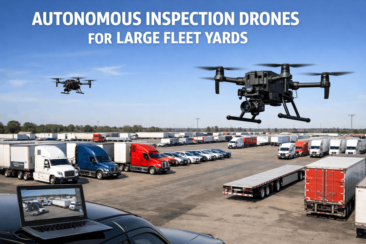
A fleet yard puts every tractor, trailer, fuel island, light pole, and drainage grate in the same few acres, yet almost nobody sees the whole picture at once. Walking a large lot to check parked units, fencing, pavement, lighting, and storage areas takes hours that technicians rarely have to spare. Drones can compress that survey into a short flight and return photos that look the same from one visit to the next. The value appears only when each finding becomes a tracked job, which is where fleet maintenance software built around work orders closes the loop between imagery and repair.
Drone Inspection for Fleet Yards: See the Whole Lot Before Small Problems Become Big Ones
Large yards hide leaks, damaged fencing, failed lighting, and units that have not moved in weeks. A repeatable aerial survey, tied to maintenance work orders, gives fleet teams a current view of the yard and a clear path from observation to repair.
Why large fleet yards are hard to inspect on foot
Yard inspection usually gets squeezed between dispatch pressure and shop backlog. The result is a lot that is checked when something goes wrong rather than on a schedule.
- Scale. A walk-around of a multi-acre lot consumes a technician or supervisor for a large part of a shift, so it gets postponed.
- Blocked sightlines. Dense trailer rows and stacked equipment hide fence damage, leaks, and debris from ground-level view.
- Elevated assets. Roofs, rooftop units, light heads, and tank tops are difficult and risky to check from a ladder.
- Inconsistent records. One person writes notes, another takes phone photos, and nothing is comparable across weeks.
- Long-parked units. Vehicles that sit unused develop flat spots, dead batteries, and fluid leaks that nobody sees until dispatch needs them.
- Weather and season. Mud, snow, standing water, and heat change surface and drainage conditions faster than a monthly walk can track.
What a drone adds to each yard area, and where it stops
| Yard area | Why ground checks struggle | What the aerial view adds | Limit to respect |
|---|---|---|---|
| Perimeter fence and gate | Long distances, overgrown edges | Continuous view of breaks, leaning posts, gate alignment | Cannot test gate operators or locks |
| Trailer and tractor rows | Tight spacing hides what is between units | Row layout, spacing, obvious leaks or staining on pavement | Cannot inspect brakes, tires in detail, or underbody |
| Pavement and drainage | Ponding is easiest to see after rain, from above | Potholes, cracking, standing water, blocked grates | Surface view only, not subgrade condition |
| Fuel island and tanks | Elevated tank tops, spill staining | Overview of containment, staining, canopy condition | Does not replace required fuel system inspections |
| Shop roof and rooftop equipment | Ladder access, fall risk | Ponding, membrane damage, debris, loose flashing | Not a substitute for a roofing specialist when damage is suspected |
| Lighting and signage | Failures show only at night, on tall poles | Damaged heads, leaning poles, missing signs | Night flights need extra authorization and care |
A drone sees the yard. It does not inspect the vehicle.
Good fits for aerial survey
- Site condition and housekeeping
- Fence, gate, and lighting damage
- Pavement defects and standing water
- Roof and rooftop equipment overview
- Parking layout, spacing, and blocked lanes
- Before and after documentation of repairs
Still needs a technician
- Brake, steering, and suspension condition
- Tire wear and tread depth
- Underbody, frame, and fluid system checks
- Driver vehicle inspection reports
- Annual and periodic inspections
- Any defect that affects safe operation
The aerial survey is a site-condition tool. Vehicle safety inspections remain the job of drivers and qualified technicians.
From flight to work order in five steps
Imagery is only useful when somebody owns each finding. This loop keeps the aerial survey connected to the maintenance backlog.
Plan the route
Define fixed flight paths per pass so every survey captures the same angles and altitudes.
Fly and capture
Record stills and video with date, time, and weather noted for later comparison.
Review and tag
A supervisor marks each finding with a zone, an asset, and a severity level.
Create work orders
Each confirmed finding becomes a job with an owner, priority, photo, and due date.
Verify and compare
The next flight confirms the repair and highlights anything that returned.
Tagging conventions that keep data usable
- Use the same zone names in the flight plan and in the maintenance system.
- Link every finding to an asset record, even when the asset is a fence section or a light pole.
- Record severity at review time, not weeks later when memory fades.
- Close findings only after a follow-up image or an on-site confirmation.
A simple risk matrix for aerial findings
Not every observation deserves the same urgency. Scoring by likelihood of harm and consequence keeps urgent hazards ahead of cosmetic items.
Colors run from low priority (light) to critical (strongest). Map each tier to a work order priority in your maintenance system.
Turn every aerial finding into a tracked repair
Create yard assets, log findings with photos, and assign work orders your crew can close from a phone. See how the process fits your lot.
Regulatory and safety essentials before you fly
Commercial drone work in the United States falls under FAA rules. Confirm current requirements with a certificated remote pilot, because rules are changing.
Part 107 basics
Routine commercial flights by small drones require a remote pilot certificate and are generally limited to visual line of sight, under 55 pounds, and below 400 feet above ground level.
Airspace
Yards near airports may sit in controlled airspace and need authorization before flight. Check airspace every time rather than assuming last month's answer still holds.
Beyond line of sight
Flying beyond visual line of sight currently needs an FAA waiver or another approval. The proposed Part 108 framework had not been finalized in the latest reports reviewed, so verify its status.
Remote ID and records
Drones generally must broadcast Remote ID. Keep pilot certificates, flight logs, and maintenance records for the aircraft organized alongside your fleet records.
People and privacy
Tell employees and neighbors what the program covers, avoid flying over people, and set a retention rule for imagery that shows faces or plates.
Insurance and vendors
Confirm that your policy or your contractor's policy covers the flights, and require proof of certification if you outsource the work.
How often to fly, and what each flight should cover
Pass B: rows, pavement, idle units
Looks for leaks under parked units, blocked lanes, new damage, and vehicles that have not moved.
Pass A: perimeter, gates, lighting
Compares fence line, pole alignment, and signage against the prior month's imagery.
Pass C: structures and utilities
Reviews roofs, canopy, fuel area containment, wash bay drainage, and dock door exteriors.
Storm, flood, or incident survey
Fast documentation of damage for insurance, safety review, and repair prioritization.
Aerial surveys that go nowhere versus ones that drive repairs
Survey without follow-through
- Photos sit in a shared folder with no owner
- Zone names differ from the maintenance system
- Findings are emailed and forgotten
- No follow-up flight to confirm repairs
- Drone replaces the walk-around entirely
Survey tied to maintenance
- Each finding becomes a work order with an owner
- Zones match asset locations in the system
- Severity sets priority and due date automatically
- The next flight verifies closure
- Drone complements technician walk-arounds
KPIs that show whether the program is working
| Metric | What it tells you | Healthy direction |
|---|---|---|
| Survey completion rate | Whether planned flights actually happen | Steady at plan |
| Time from finding to work order | How quickly review turns into action | Shorter |
| Findings closed within target | Whether crews respond to priority levels | Higher |
| Repeat findings per zone | Which areas keep failing after repair | Lower |
| Idle unit age | How long vehicles sit without moving | Lower |
| Yard-related incidents | Slips, strikes, spills, and security events | Lower |
Where Oxmaint fits into a yard inspection program
Oxmaint does not fly the drone. It is where the results of the flight become organized, assigned, and verified work.
Asset records for the yard
Register gates, light poles, fuel equipment, roofs, and fence sections alongside vehicles so every finding has a home.
Inspection checklists
Use mobile checklists for the ground follow-up a technician performs after a flagged finding.
Work orders with evidence
Attach photos, assign owners, set priorities, and track completion from the same record.
Preventive scheduling
Turn recurring yard tasks, such as drainage cleaning and lighting checks, into scheduled preventive maintenance.
Parts and inventory
Track common yard spares such as lamps, fence hardware, and gate components so repairs are not delayed.
Reporting
Review backlog age, repeat failures by zone, and completion rates in dashboards your managers can read quickly.
Pre-flight and post-flight checklist for yard surveys
Before the flight
- Certified remote pilot assigned
- Airspace and weather confirmed
- Battery and aircraft condition logged
- Crew and nearby staff notified
- Route and zone list loaded
After the flight
- Imagery stored with date and zone names
- Findings reviewed within one working day
- Work orders created for confirmed items
- Urgent hazards escalated the same day
- Flight log and aircraft notes updated
Reading pavement, ponding, and drainage from above
Water is the most common cause of yard deterioration, and it is far easier to see its pattern from the air than from the ground. A flight shortly after rain shows where water collects and how long it stays.
Ponding
Standing water near trailer pads or lanes points to low spots, failed grading, or a blocked inlet. Repeated ponding in one place is a work order, not a one-time observation.
Cracking patterns
Alligator cracking under heavy wheel paths suggests a base problem. Isolated linear cracks are usually cheaper to seal early than to patch later.
Staining
Dark patches under parked units can indicate leaking fluids. A technician should confirm the source before it is written up as a vehicle repair.
Debris and blocked grates
Leaves, mud, and trash around grates tell you which drains need cleaning before the next storm.
Why this belongs in preventive maintenance
- Drain cleaning and sweeping become scheduled tasks rather than reactions to flooding.
- Pothole patching is tracked by location, so repeat repairs show up in reports.
- Photos taken at the same point each month create a simple visual history.
- Oil and fluid control around the wash bay and fuel island stays on a documented schedule.
Spotting units that have stopped moving
A vehicle that sits for weeks quietly accumulates problems. Aerial photos taken on a fixed schedule make parking position changes obvious without a lot walk.
Idle counts are only as good as your asset records. Keep location and status current so the survey can be matched to the right vehicle.
Using aerial views for yard safety, not only repairs
- Traffic flow. Look for lanes narrowed by parked equipment, blind corners, and pedestrian routes that cross truck paths.
- Fire access. Confirm that hydrants, extinguisher points, and emergency lanes are not blocked.
- Perimeter. Spot fence breaches and gaps that allow theft of parts, fuel, or equipment.
- Fuel area. Check containment, signage, and housekeeping around dispensers and tanks.
- Lighting coverage. A night review of dark zones helps prioritize pole and fixture repairs.
In-house flights or a drone service provider?
In-house program
- Flexible timing after storms or incidents
- Staff build site knowledge over time
- Needs a certified pilot, equipment, and training
- You manage aircraft upkeep and records
Service provider
- No equipment or certification to maintain
- Good for quarterly or one-time surveys
- Request proof of certification and insurance
- Agree on file formats, naming, and delivery time
Drone inspection for fleet yards, answered
Can a drone replace the daily vehicle walk-around?
No. Drivers and technicians still inspect brakes, tires, and safety components. The drone covers site conditions and long-distance visibility.
How often should a large fleet yard be flown?
Many teams fly rows weekly, perimeter monthly, and structures quarterly, plus after storms. Adjust to risk, size, and local rules.
Do I need an FAA certificate to fly a yard survey?
Commercial flights generally need a Part 107 remote pilot certificate, and airspace rules still apply. Confirm details with a certificated pilot.
How do aerial findings become maintenance jobs?
Tag each finding to an asset and zone, then create a prioritized work order. You can start in Oxmaint to set this up.
What should I measure first?
Start with time from finding to work order and the share closed within target. A short demo session can help set up dashboards.
Give your yard the maintenance attention it deserves
Connect aerial observations, ground inspections, and repairs in one maintenance workflow. Start organizing your yard today or talk through your setup with our team.