Vegetation accounts for over 25% of all transmission line outages globally — yet most utilities still rely on manual patrols, helicopter surveys, and reactive trimming schedules that are expensive, slow, and dangerously behind the problem. AI-powered drone inspection combined with LiDAR and real-time analytics is changing that equation entirely. Utilities deploying intelligent drone inspection programs are detecting faults 14–21 days earlier, covering 10x more corridor per crew day, and reducing vegetation-related outages by up to 60%. Start managing your transmission assets intelligently — free trial, no credit card, live in under 60 minutes.
Grid & Distribution · AI Drone Inspection · OxMaint
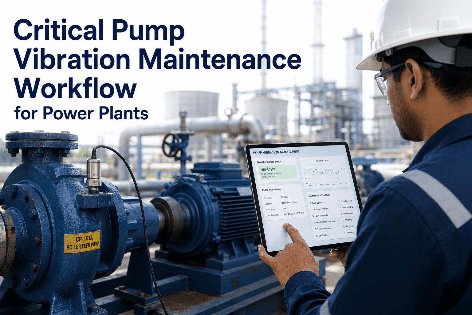
AI-Powered Transmission Line Inspection & Vegetation Management Using Drones
From LiDAR corridor scanning to real-time fault detection and vegetation encroachment alerts — the utilities winning in 2030 are building their drone inspection foundation now. Every unmanned flight generates the asset intelligence that makes your grid more reliable, your crews more productive, and your CapEx decisions data-driven.
60%
Reduction in Mean Time to Repair with AI-assisted drone inspection
10x
More corridor covered per crew day vs manual ground patrol
40 mph
Inspection speed of UAVs — far exceeding truck-based methods
18 mo
Predictive vegetation growth forecast horizon with AI analytics
The Real Cost of Doing Nothing
Why Traditional Line Inspection Is Failing the Grid
Manual patrols, helicopter surveys, and calendar-based trimming were designed for a simpler grid. Today's transmission network demands continuous, intelligent, data-driven oversight.
25%
of all transmission outages caused by vegetation contact — the most preventable failure mode in the grid
4.8x
cost of emergency line repair versus proactive maintenance triggered by early AI anomaly detection
68%
of utility maintenance remains reactive today — triggered after failure, not before it
$300–2K
per-mile cost for professional drone inspection, versus $8,000+ per mile for helicopter survey methods
How It Works
From First Flight to Actionable Work Order — The AI Drone Inspection Pipeline
OxMaint connects every stage of the drone inspection workflow into one unified data platform — so nothing gets lost between capture and corrective action.
01
Autonomous Corridor Patrol
Fixed-wing or multirotor UAVs fly pre-programmed routes along transmission corridors at speeds up to 40 mph. RGB, thermal, and LiDAR sensors capture simultaneous data streams across every span and structure.
→
02
AI Image & LiDAR Processing
Computer vision models analyze thousands of images in real time, flagging cracked insulators, conductor sag, corona discharge, corrosion, and vegetation encroachment — graded by severity and GPS-tagged to the structure.
→
03
Vegetation Risk Scoring
LiDAR point cloud data is processed with AI growth-rate models to forecast vegetation contact risk up to 18 months ahead. Encroachment heat maps prioritize trim crews to the highest-risk spans before failures occur.
→
04
Auto Work Order Generation
OxMaint automatically generates structured work orders from flagged anomalies — assigned to the right technician, linked to the full asset record, and tracked from dispatch to close with photo verification.
Sensor Intelligence
What the Drones Actually See — Multi-Sensor Payloads Explained
RGB Camera
High-resolution visual capture of insulators, conductors, hardware fittings, and tower structures. Detects physical damage, corrosion, and missing components with millimeter accuracy at safe standoff distances.
Thermal / Infrared
Identifies electrical hotspots caused by loose connections, overloaded conductors, or failing joints — invisible to RGB cameras. Critical for detecting failures before they cause outages or fires.
LiDAR
3D point cloud mapping of the entire corridor. Measures conductor sag, tower lean, and exact vegetation clearance distances. The foundation of accurate right-of-way vegetation management and line sag modeling.
Corona UV Detection
Detects partial electrical discharge around insulators and hardware — a leading indicator of insulation breakdown that precedes catastrophic failure by weeks or months. Invisible to all other sensor types.
Before vs. After
Helicopter Surveys & Manual Patrols vs. AI Drone Inspection
| Inspection Area |
Traditional Methods |
AI Drone Inspection |
| Coverage Speed |
2–5 miles per day (ground crew) |
40+ miles per day per UAV |
| Vegetation Monitoring |
Annual or bi-annual manual survey |
Quarterly LiDAR scans with 18-month predictive forecast |
| Fault Detection |
After failure or visual observation |
14–21 days before failure via thermal & AI anomaly scoring |
| Inspector Safety |
High-risk: climbing, hot lines, remote terrain |
Zero personnel exposure to live infrastructure |
| Data Output |
Paper logs, handwritten field notes |
GPS-tagged defects, 3D models, AI-graded severity reports |
| Cost per Mile |
$8,000–$15,000 (helicopter) |
$300–$2,000 (drone) |
| Work Order Creation |
Manual — days after inspection |
Automatic — minutes after AI processing |
OxMaint Platform
Everything Your Drone Inspection Program Needs in One Platform
OxMaint bridges the gap between drone data capture and field execution — so every inspection flight translates into structured asset intelligence and completed maintenance work.
Asset Intelligence
Full Transmission Asset Registry
Every tower, span, insulator string, and conductor logged with full hierarchy — corridor, circuit, structure, component. Condition scores from drone inspection data update automatically. Asset replacement decisions backed by real data, not calendar age estimates.
Vegetation
Right-of-Way Vegetation Tracking
Encroachment risk scores per span. Growth rate projections. Trim priority queues updated after every LiDAR flight. Crews dispatched to the right segments at the right time — not on a fixed annual calendar.
Work Orders
Auto-Generated Maintenance Dispatch
Flagged anomalies from AI inspection become structured work orders automatically — assigned, tracked, and closed with full asset history and photo verification. Nothing falls through the gap between detection and repair.
Compliance
Audit-Ready NERC FAC Compliance
Digital inspection records with timestamped entries, GPS data, and electronic sign-off built into every work order. FAC-003 vegetation management compliance documentation — one-click export, no binder preparation required.
Analytics
Portfolio-Level Dashboard
Every corridor, every circuit, every defect visible in one platform. Severity heat maps, trend analysis, and KPI reporting updated in real time. Operations and reliability teams see the same picture — no reconciliation between field logs and office systems.
CapEx
Data-Driven Capital Planning
Rolling 5–10 year capital expenditure forecasts built from real asset condition data gathered during drone inspections. Board-ready CapEx reports automatically — no spreadsheet estimates, no manual compilation.
The Data Foundation for Intelligent Grid Maintenance Starts Now
Every drone flight without a structured CMMS behind it generates data that gets lost. OxMaint captures, structures, and acts on every inspection finding — turning flight data into field work automatically.
Measurable Returns
What Utilities Are Reporting in the First Year of AI Drone Inspection
3x
Inspection Capacity
Same workforce, 3x the corridor coverage — reported by a utility processing 675,000+ inspection images across 267 sites with AI-assisted analysis
60%
Faster Fault-to-Repair
Mean time to repair cut by 60% when AI-detected faults auto-generate work orders linked directly to ticketing and dispatch systems
35%
Carbon Reduction
E.ON Sweden reduced 35 tons of carbon emissions across 10,000 km of inspection corridor by replacing helicopter surveys with automated drone programs
12 mo
Full ROI Payback
Utilities deploying modern CMMS and drone inspection programs consistently report positive return on investment within the first full year of deployment
Technology Roadmap
Where Transmission Line Inspection Is Heading Through 2030
2025
AI-Assisted Inspection at Scale
AI defect detection and vegetation scoring reach production deployment across major utilities. Drone inspection programs standardized in 4-star and above transmission operators. CMMS platforms begin ingesting drone data automatically.
2026
BVLOS Operations Go Mainstream
FAA and international regulators finalize BVLOS frameworks, enabling long-corridor autonomous patrols without line-of-sight restrictions. Single drones cover entire transmission corridors without repositioning ground teams.
2027
Drone-in-a-Box Continuous Monitoring
Permanent drone stations deployed at substations and tower sites enable on-demand patrols after storm events. Post-outage inspection time drops from days to hours. Real-time grid situational awareness becomes operational standard.
2028
Digital Twin Standard for Transmission
Every major transmission asset has a digital twin updated continuously from sensor and drone data. CapEx forecasting runs on live condition scores. New infrastructure commissioned with full digital twin at handover.
2030
Fully Autonomous Grid Patrol
AI-driven drone swarms inspect and diagnose entire transmission networks without manual piloting. Human engineers focus on complex diagnostics and stakeholder decisions. Utilities without this infrastructure face permanent reliability and cost disadvantage.
Common Questions
What Grid Operations Leaders Ask About AI Drone Inspection
How does OxMaint integrate with drone inspection data?
OxMaint connects to drone data platforms via standard APIs, ingesting GPS-tagged defect reports, AI severity scores, and LiDAR vegetation data automatically. Defects flagged during flight become structured work orders in OxMaint within minutes — assigned to the right technician, linked to the full asset record, and tracked through to close. No manual re-entry, no data loss between inspection and action.
Book a demo to see the full drone-to-work-order workflow live.
Does a utility need to own drones to benefit from this approach?
No. The majority of utilities begin with third-party drone inspection contractors or managed service providers — and that data feeds directly into OxMaint regardless of who operates the aircraft. What matters is that inspection findings are structured and actionable. OxMaint provides the platform that turns any drone inspection output, from any provider, into organized asset records, work orders, and CapEx data.
Start the free trial and see how your current inspection data can be structured immediately.
What regulations govern drone transmission line inspection?
In the U.S., FAA Part 107 governs commercial drone operations, with BVLOS waivers required for long-corridor autonomous flights. NERC FAC-003 sets vegetation management compliance standards for transmission operators. In Europe, EASA's harmonized UAS regulations increasingly support BVLOS operations. OxMaint's digital inspection records satisfy FAC-003 documentation requirements and export as audit-ready compliance evidence at any time — no binder preparation required.
Book a demo to see how compliance documentation works in the platform.
How quickly can a utility see ROI from AI drone inspection?
Most utilities report measurable ROI within the first 12 months — primarily through avoided emergency repair costs, reduced helicopter survey spend, and faster fault-to-repair cycles. The compounding benefit is the data foundation: every inspection flight builds the asset condition history that makes AI predictions more accurate over time. Utilities that start now will have a 3–5 year data advantage over those that wait.
Start your free trial today and begin building that foundation from your first inspection.
Full Platform · Transmission & Distribution · Free to Start
Your Grid Generates Data Every Day. Start Turning It Into Decisions.
Full transmission asset registry. Drone inspection data ingestion. Auto-generated work orders from AI-flagged defects. Vegetation risk scoring and right-of-way management. NERC FAC-003 compliance documentation. Rolling CapEx forecasting from real condition data. Portfolio dashboards across every corridor and circuit. No heavy implementation. No long onboarding. Built for the grid teams making the transition to intelligent maintenance now.